Photogrammetry tool of DJI.
Why sell the tool of photogrammetry WKM Waypoint if I can not use it?
My DJI Wookong is waypoint, I bought the license for 50 points in order to use the tool of photogrammetry.
I have many doubts about the photogrammetry tool and the manual does not have much information on how to generate files of GPS data.
After the mission, I thought I would follow these procedures:
-Download images from camera.
-Download telemetry data from WKM
-Enter telemetry data associated with each photograph in my Photogrammetry Software.
But, after the mission, where is the file with GPS position data from the telemetry?.
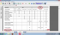
It's there in the GS manual (page 3) that the Ground Station photogrammetry tool is enabled to WKM Waypoint. If enabled then has to work properly.
With everything set up correctly, after creating a new mission, the WKM flies to the way points and fulfills the mission with dozens of photographs. So far so good, but what I do now? Where is the file containing the route of the mission in order associated with each photograph? I would like a response to the DJI on this subject, because I just bought the upgrade to use the tool of photogrammetry.
I feel cheated because who sold me the license said I could use the tool photogrammetry. Now I'm completely disappointed.
I demand a solution, Is DJI selling an incomplete
If I knew the memory limitation of WKM I would not buy a license for $ 1300, I just bought it because it is very clear in the manual page 3. Anyone who reads the Ground Station manual on page 3 can see that there is no observation about the limitation of the tool for WKM use.
Why sell the tool of photogrammetry WKM Waypoint if I can not use it?
My DJI Wookong is waypoint, I bought the license for 50 points in order to use the tool of photogrammetry.
I have many doubts about the photogrammetry tool and the manual does not have much information on how to generate files of GPS data.
After the mission, I thought I would follow these procedures:
-Download images from camera.
-Download telemetry data from WKM
-Enter telemetry data associated with each photograph in my Photogrammetry Software.
But, after the mission, where is the file with GPS position data from the telemetry?.
It's there in the GS manual (page 3) that the Ground Station photogrammetry tool is enabled to WKM Waypoint. If enabled then has to work properly.
With everything set up correctly, after creating a new mission, the WKM flies to the way points and fulfills the mission with dozens of photographs. So far so good, but what I do now? Where is the file containing the route of the mission in order associated with each photograph? I would like a response to the DJI on this subject, because I just bought the upgrade to use the tool of photogrammetry.
I feel cheated because who sold me the license said I could use the tool photogrammetry. Now I'm completely disappointed.
I demand a solution, Is DJI selling an incomplete
If I knew the memory limitation of WKM I would not buy a license for $ 1300, I just bought it because it is very clear in the manual page 3. Anyone who reads the Ground Station manual on page 3 can see that there is no observation about the limitation of the tool for WKM use.
Attachments
Last edited by a moderator: