You are using an out of date browser. It may not display this or other websites correctly.
You should upgrade or use an alternative browser.
You should upgrade or use an alternative browser.
Show us what you shot.
- Thread starter ZAxis
- Start date
fltundra
Member
Attachments
Last edited by a moderator:
SamaraMedia
Active Member
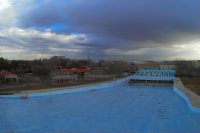
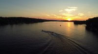
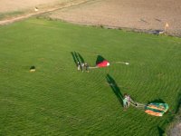
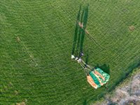
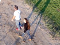
View attachment 25943 Sunset shot from a couple weeks back of ski club practicing a pyramid for ski show.
Attachments
dazzab
Member
I've been working on mapping projects with my Aeronavics XM-6 hexacopter which is controlled with a Pixhawk and Arducopter. The Mission Planner Ground Control Software is quite nice for setting up autonomous flights for this kind of work. This map consists of 213 photos taken with a Sony NEX 6 from an altitude of 80 meters. The resolution is close to 2cm/pixel. The flight took 15 mins which is close to my max flight time of 18 mins on that copter using two 5000MaH batteries.
The goal was to identify noxious weed growth (quite noticeable because they are flowering yellow). I used this project to test both the DroneDeploy mapping service, which is in beta so they offer free processing, and also the MapsMadeEasy service which I'm really impressed with. I also shot a smaller section with the DJI Inspire 1 as a comparison which worked out well. It's actually sharper and the stitching seems a bit better as well.
Orthomosaic map from MapsMadeEasy here. The 3D model they generated is interesting. By comparison here is a subset of the mission flown with the Inspire 1 and the corresponding 3D model.
All in all I'm happy with the results. I also had a Sony in a FPV Ranger plane which I'm learning to fly but had a nasty crash which destroyed both the plane and camera so I've been a bit delayed with that project. I'm adding the plane to my fleet so I can map larger areas.
Last edited by a moderator:
ebeez
Member
Attachments
jetkrazee
Uplifting-photography.com
Western North Carolina in the small community of Barnardsville. Turbo Ace Matrix. hero 3+black with cp filter at 290ft agl. View attachment 26881 View attachment 26882
Attachments
Justin Muffley
Member
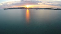
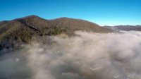
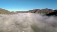
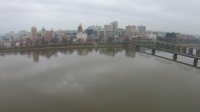
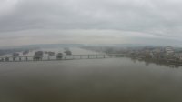
View attachment 27131 Just a few shots today of downtown before the storm rolled in.
Attachments
Justin Muffley
Member
Attachments
Hey guys, how's it going?! This is some footage i shot with a DJI F450 quadcopter and GoPro Hero 4 Black.
Specs are:
DJI F450 Flamewheel
FrSky d8rii-plus receiver
TS5823 5.8G 200mw Video transmitter
Fieldview 7" AV monitor
Aomway 4L SMA Antennas
Turnigy 9x Radio Transmitter
FrSky DJT Transmitter Module
Multistar 3S 5200mah
FeiyuTech Mini3D 3Axis Gimbal
GoPro HERO 4 Black Edition
Polar Pro ND/4
RC832 5.8G 40ch video receiver
violetwolf
Member
Yes, very nice! Especially when you consider the gear... Just goes to show its the cameraman not the camera ")